Bushfire Affected Coastal Waterways
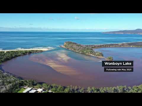
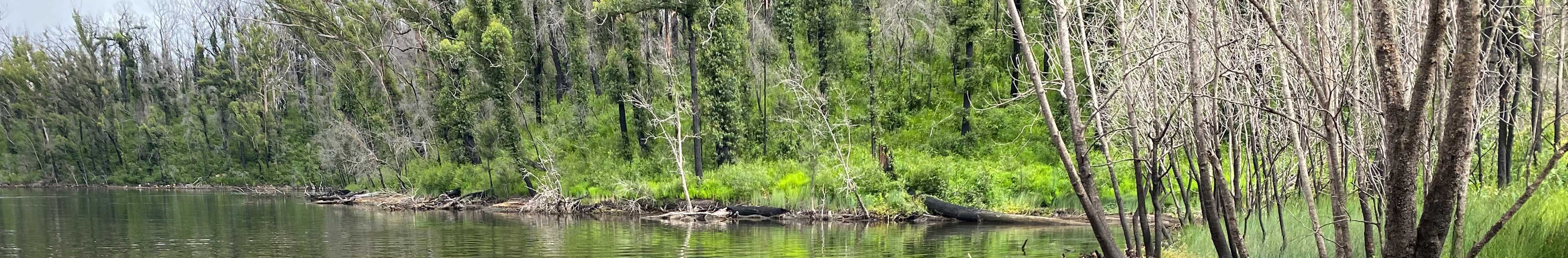
The 2019-2020 ‘Black Summer’ bushfires that burned across the Shoalhaven, Eurobodalla and Bega Valley affected more than one million hectares and impacted approximately 47 estuaries and coastal catchments. A diverse range of landscapes and ecosystems were also affected including rainforests, wet sclerophyll forests, heathlands and sensitive waterways and aquatic ecosystems. Many of these areas provide habitat and support for threatened animal species.
The fires were immediately followed by large amounts of rainfall that generated large volumes of surface runoff and flooding, which triggered large-scale mobilisation of ash, soils and sediment.
Shoalhaven City Council, Eurobodalla Shire Council and Bega Valley Shire Council have received joint grant funding from the NSW Government, under the NSW Bushfire Affected Coastal Waterways Program, to develop a South-East Catchment and Waterways Bushfire Recovery Plan.
All three Councils also received funding from the NSW Government for on-ground works. For the Shoalhaven this includes funding to undertake the Shoalhaven Local Government Area (LGA) Catchment Stabilisation and Ecological Monitoring Works Project.
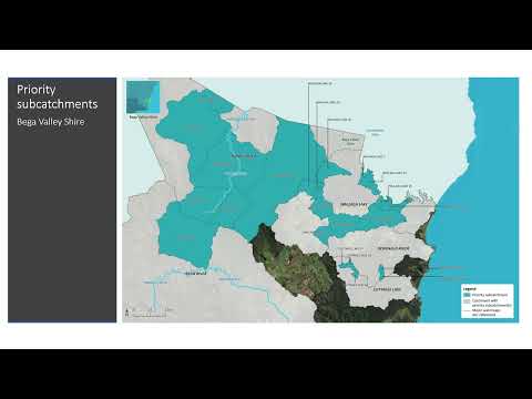
South-East Catchment and Waterways Bushfire Recovery Plan
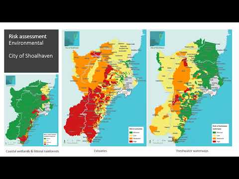
Alluvium Consulting Australia Pty Ltd was engaged by Shoalhaven City Council to prepare a the Catchment and Waterways Bushfire Recovery Plan for south-east NSW on behalf of Shoalhaven City Council, Eurobodalla Shire Council and Bega Valley Shire Council. The plan aims to provide consistency and efficiency in the recovery efforts across all three LGAs.
The objective of the plan is to prioritise high-risk sites for targeted ecological restoration activities to aid bushfire recovery and build environmental resilience.
This plan was completed in November 2021.
Shoalhaven LGA Catchment Stabilisation and Ecological Monitoring Works
The objective of this project is to monitor the water quality of high-risk estuaries and implement ecological restoration works at priority sites within the Shoalhaven as set out in the South-East Catchment and Waterways Bushfire Recovery Plan.
Shoalhaven City Council will endeavour to implement the ecological restoration activities at priority sites over the next 2 years. Further funding will be required to implement additional sites throughout the project. Further funding may be required to implement activities at additional sites and achieve longer-term actions.
In November 2020 monthly water quality monitoring commenced at the following estuaries within the Shoalhaven LGA:
- Shoalhaven River
- St. George’s Basin
- Swan Lake
- Lake Conjola
- Burrill Lake
- Lake Tabourie
- Narrawallee Inlet.
The water quality monitoring program was completed in April 2023.
The funding for this project is scheduled for completion in June 2024.
Stay Informed
Subscribe for updates on this project via the 'Stay Informed' function on this web page.
-
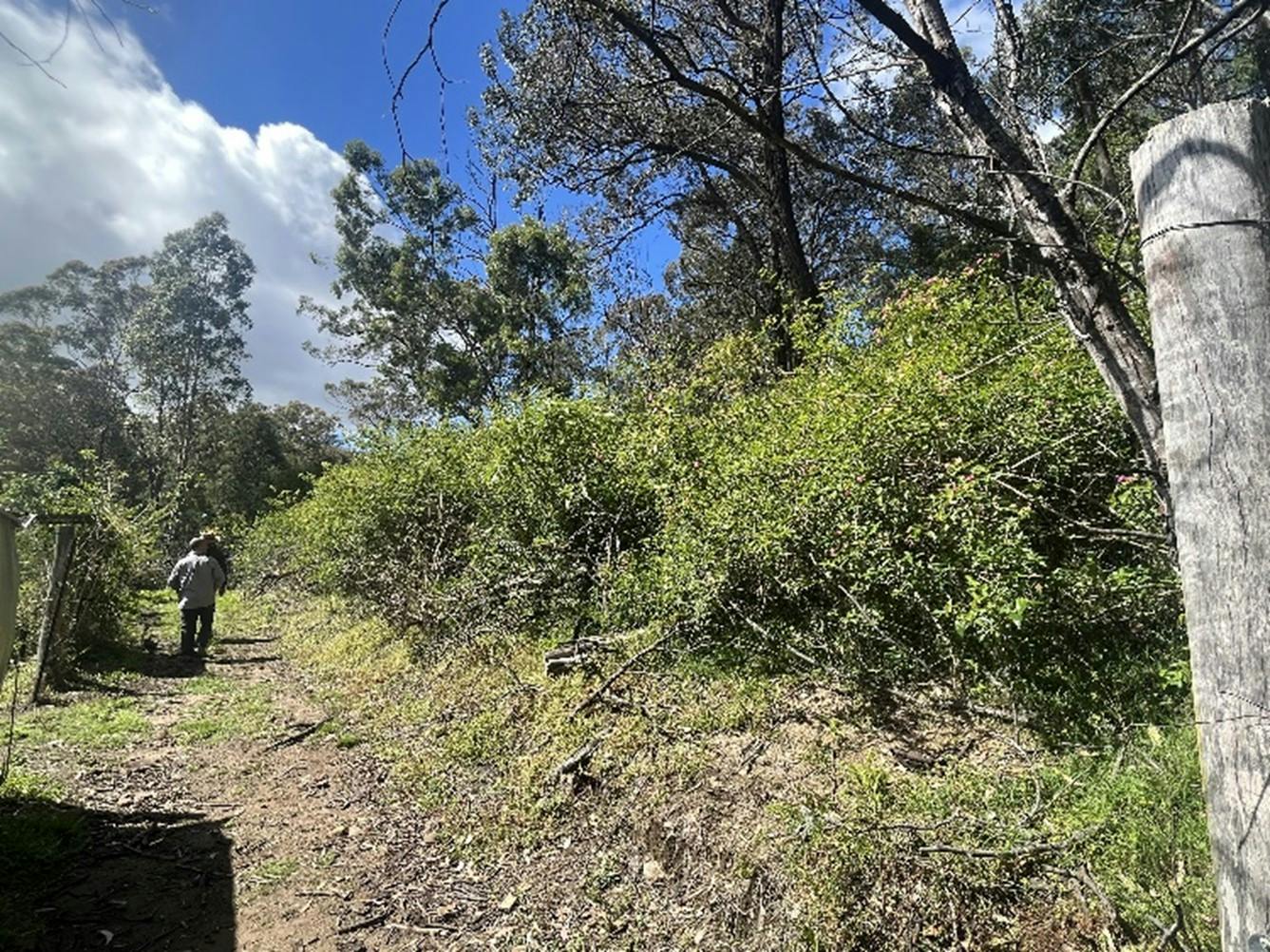
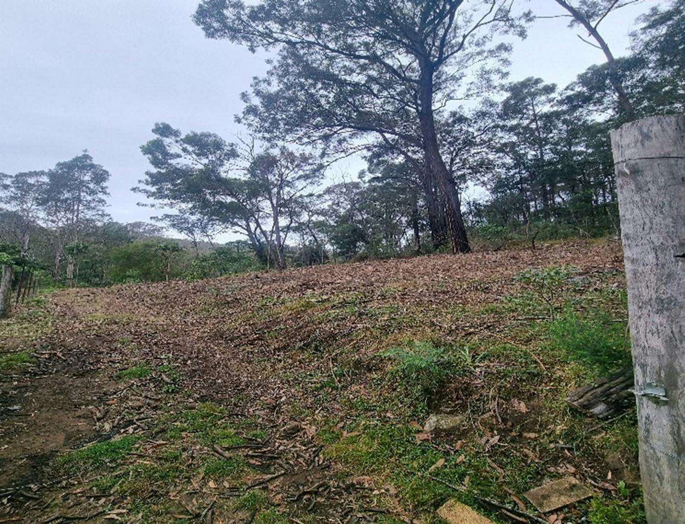
Wandandian Creek Bank Stabilisation Project
Share Wandandian Creek Bank Stabilisation Project on Facebook Share Wandandian Creek Bank Stabilisation Project on Twitter Share Wandandian Creek Bank Stabilisation Project on Linkedin Email Wandandian Creek Bank Stabilisation Project linkEcodynamics Landscaping, on behalf of Shoalhaven City Council, completed the Wandandian Creek Bank Stabilisation Project in April 2023.
The project aim was to protect the bank from further bank erosion to reduce sediment entering the waterway and impacting on waterway health.
The project works involved:
- reprofiling the bank to create a gentler slope
- placing rock at the toe of the bank and approximately 1.5-2m up the lower bank
- placing jute matting on the upper bank from the top of the rock revetment to the top of the bank
- placing fallen timber and coir logs at the top of the rock revetment and top of the bank
- planting native trees, shrubs, grasses and sedges into the jute matting and surrounding disturbance areas.

-
Burrier Weed Control Project
Share Burrier Weed Control Project on Facebook Share Burrier Weed Control Project on Twitter Share Burrier Weed Control Project on Linkedin Email Burrier Weed Control Project linkThe National Trust of Australia (NSW) completed weed control works on a property in Burrier between January and June 2023, on behalf of Council. The project location was on the Shoalhaven River area that was impacted by the 2019-2020 bushfires and subsequent floods causing significant weed infestations and erosion. The project targeted three key weed species using herbicide and manual methods of control. Following two rounds of weed control, native revegetation was undertaken on the eroded riverbanks and areas left bare after extensive weed control.
Target weeds:
- Solanum mauritianum Tobacco Bush
- Lantana camara Lantana
- Rumex sagittatus Turkey Rhubarb


-
OceanWatch Tour
Share OceanWatch Tour on Facebook Share OceanWatch Tour on Twitter Share OceanWatch Tour on Linkedin Email OceanWatch Tour link
Join OceanWatch on Tuesday 16 August or Thursday 18 August 2022 for a FREE Bushfire Resilience Tour of the Shoalhaven catchment and coastal areas through the lens of bushfire recovery and resilience.
The tour content is the same each day and lunch will be provided.
You will learn about:
- an introduction to bushfire management from Rural Fire Services (RFS) experts
- cultural aspects of bushfire resilience by the Jerrinja Tribal Owners
- local environmental recovery projects by Shoalhaven Riverwatch
- the impacts of bushfires to waterways and the ecology of the estuary
- local oyster farming and the impacts of bushfires to this industry.
WHAT: Bushfire Resilience Tour. Locations visited include Nowra Fire Control Centre, Seven Mile Beach and Greenwell Point.
WHERE: The meeting point is at the Nowra Fire Control Centre, 92 Albatross Rd, South Nowra
WHEN: Tuesday 16 or Thursday 18 August 2022
TIME: 9:00am to 3:30pm
LUNCH: Provided at The Heads Hotel, Shoalhaven Heads
WHAT TO BRING: Protective clothes against the weather, your water bottle.
WHO: Everyone is welcome. Please contact us if you have any accessibility requirements and we will do our best to assist you.
COST: Free!
The opportunity of a free tour doesn't present itself often, and places are limited, so make sure you secure your spot!
Book NOW at https://events.humanitix.com/bushfire-resilience-shoalhaven-free-tour
-
Environmental Support for Shoalhaven Property Owners
Share Environmental Support for Shoalhaven Property Owners on Facebook Share Environmental Support for Shoalhaven Property Owners on Twitter Share Environmental Support for Shoalhaven Property Owners on Linkedin Email Environmental Support for Shoalhaven Property Owners link
Council has funding available to support Shoalhaven property owners with ongoing environmental issues caused by the Black Summer 2019-20 bushfires. The NSW Government, as part of their Bushfire Affected Coastal Waterways Program, has provided funding for the recovery of our coastal waterways. The focus has been on the erosion and sedimentation issues impacting waterway health.
Council is calling for Expressions of Interest (EOIs) from property owners in relation to erosion and sediment control issues impacting on our local waterways, including bank stabilisation, fencing off riparian areas, revegetation and weed control.
Submit an expression of interest by completing the Online Application Form on this web page.
Note: funding is limited, and all requests will need to be assessed against the project objectives and priorities.