FAQs
- Historic events
- Current conditions
- Future trends including population growth, environmental conditions, and climate change.
- Identified local priority management issues.
- Reviewed the performance of existing management.
- Identified information gaps.
- Identified how consultation and engagement should take place during preparation of a CMP.
- Beach erosion
- Shoreline recession
- Coastal lake or watercourse entrance instability
- Coastal inundation
- Coastal cliff or slope instability
- Tidal inundation
- Erosion and inundation of foreshores caused by tidal waters and wave action, including the interaction of those waters with catchment floodwaters.
- Local management issues, challenges and opportunities.
- Effectiveness of existing management approaches and land use planning instruments to address current and future challenges, including climate change
- Responsibilities and capacities of council, public authorities, communities and other stakeholders to address coastal management issues.
- Future population growth and development pressures.
- Risks and liabilities associated with coastal hazards and threats to coastal environments.
- Vulnerability of coastal assets, environments and social and economic systems.
- Potential opportunities to adapt to change and thereby enhance the resilience of natural features and coastal communities.
- Lake Conjola (high priority)
- Shoalhaven Open Coast (high priority)
- Jervis Bay (high priority)
- Sussex Inlet, Swan Lake and Berrara Creek (high priority)
- St. Georges Basin (high priority)
- Lower Shoalhaven River (high priority)
- Lake Wollumboola (medium priority)
- Burrill Lake, Lake Tabourie and Willinga Lake (medium priority)
- Currambene Creek and Moona Moona Creek (medium priority)
Shoalhaven Urban and Rural Estuaries (lower priority)
- Shoalhaven City Council staff.
- State Government Agencies: Crown Lands, Department of Planning and Environment (DPE) – Coast & Estuaries and Heritage Teams, Department of Primary Industries (DPI) – Fisheries and Agriculture Teams, Local Land Services (LLS), National Parks & Wildlife Services (NPWS), Transport for NSW (TfNSW) – Maritime.
- Australian Marine Parks.
- Council’s appointed Coastal Management Program Advisory Committees.
- Local Aboriginal Lands Councils (LALCs).
- Traditional Owners and Aboriginal communities.
- Other surrounding Councils.
- Volunteer organisations i.e. Marine Rescue, State Emergency Service (SES), Lifesavers.
- Local community groups.
- Residents.
- Council’s appointed Youth Committee.
- Visitors to the Shoalhaven.
What is a Coastal Management Program?
A Coastal Management Program (CMP) is a long-term strategy for managing the coastal zone. A CMP provides a framework and strategy that will be used to manage our coastline and estuaries. The CMPs will consider:
Through five stages of development, each CMP will work to determine risks and vulnerabilities associated with coastal hazards, identifying opportunities and options to mitigate these risks through management actions. The CMP will outline how and when each management action will be implemented, the associated costs, and potential funding mechanisms. Stages 1-4 develop and build the business plan in close consultation with the community and state government agency stakeholders. Stage 5 focusses on the implementation of the management actions over a 10-year timeframe.
Why is Council preparing Coastal Management Programs?
CMPs are required in accordance with the Coastal Management Act 2016 for our estuaries and coastline, to replace the pre-existing Coastal Zone Management Plans (CZMP), developed under the now repealed Coastal Protection Act 1979, and Estuary Management Plans.
The CMPs will be developed and guided by the NSW State Government's Coastal Management Manual.
What are the stages of developing a CMP?

Stage 1 - The first step is to identify the scope of a CMP through a Scoping Study (Stage 1). The Scoping Study incorporates local priority management issues, reviews existing management plans, identifies information gaps, and identifies how consultation and engagement should take place during preparation of the remaining stage of a CMP.
Stage 2 – Stage 2 includes gathering technical data, community and stakeholder consultation and addressing the gaps identified through the existing first-pass risk assessment (completed during the Stage 1 Scoping Study). The information collected will assess, characterise and summarise local coastal/estuary processes and hazards to determine the risks and vulnerabilities being faced within the study area which will inform decision-making within Stage 3.
Stage 3 – Stage 3 includes the confirmation of the strategic direction, identifying and evaluating potential management actions, and further community and stakeholder consultation regarding identifying coastal management actions and determining their viability. Stage 3 will include the development of a draft business plan that will include strategic direction, potential management actions, feasibility evaluation, identify and evaluation of management options, maps and scheduling.
Stage 4 – This stage involves preparing a draft CMP that will be open for public exhibition over a minimum period of 28 days. Following public exhibition, a final coastal management program is to be prepared that incorporates any necessary amendments as a result of submissions by the general community or public authorities. The CMP will need to meet all statutory and mandatory requirements which will then be submitted to the Minister for Local Government for certification.
Stage 5 – Stage 5 begins once the CMP has been certified by the Minister for Local Government, allowing Council to begin working collaboratively with our stakeholders, contractors and Government agencies to implement, monitor and evaluate the management actions within the finalised CMP.
What is a Scoping Study?
Stage one of the five stage process is to identify the scope of a CMP which results in a Scoping Study.
In Shoalhaven, Council has prepared a single Citywide Scoping Study for the open coastline and estuaries managed by Council.
The Citywide Scoping Study:
Council engaged a team of coastal specialists to prepare the Citywide Scoping Study along with community engagement specialists that undertook community workshops and drop-in sessions.
What is a coastal vulnerability area and how is it identified?
The Coastal Management Act 2016 (CM Act) defines four coastal management areas that make up the coastal zone; coastal wetlands and littoral rainforests area, coastal vulnerability area, coastal environment area and coastal use area.
The State Environmental Planning Policy (Resilience and Hazards) 2021 (RH SEPP), currently maps three of these areas, using the best available information. The RH SEPP does not yet include maps of the coastal vulnerability area.
The coastal vulnerability area is the area affected by coastal hazards defined by the CM Act, which include beach erosion, shoreline recession, coastal lake or watercourse entrance instability, coastal inundation, tidal inundation and coastal cliff or slope instability.
The existing information on coastal hazards within Council’s Shoalhaven Local Environmental Plan 2014 (LEP) and Shoalhaven Development Control Plan 2014 (DCP), continues to apply when considering development applications in the coastal zone.
The Scoping Study identified improvements to be made to the existing gaps in information that will be addressed within Stages 2 and 3 based on the best available scientific information. As part of the Scoping Study process and Stage 2, information prepared by the State Government including the Sea Level Rise – Science and Synthesis for NSW, The NSW Estuary Tidal Inundation Exposure Assessment and Coastal Erosion in NSW – Statewide Exposure Assessment will be used to assist Council to identify where existing information needs to be reviewed or where additional studies may be required
What is the vision of the CMPs?
The CMPs being developed, set a long-term strategy for the coordinated management of our coastline. The vision overarching the development of our CMPs is that 'We care for and protect the coast so that current & future generations continue to be refreshed & inspired by their coastal experience.'
What are the issues being considered by the CMPs?
Each CMP will work to determine risks and vulnerabilities associated with coastal hazards, identifying opportunities and options to mitigate these risks through management actions, while achieving the objects and objectives of the CM Act.
A CMP addresses the seven coastal hazards outlined in Section 4 of the Coastal Management Act 2016. That section identifies the following as coastal hazards:
Each council has different issues, challenges and opportunities in coastal management. The scope of the CMPs for Shoalhaven’s coastline and estuaries are specific to:
How many CMPs is Council preparing?
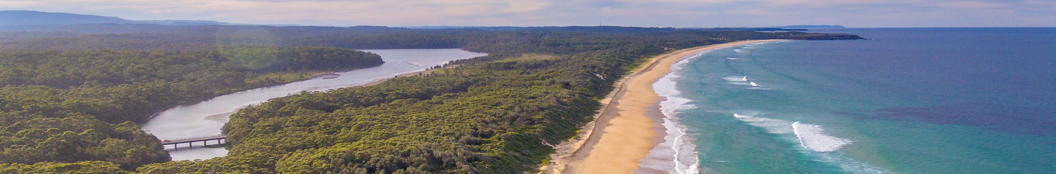
The coastal landscape of Shoalhaven LGA is a valuable natural, social, and economic asset for the community and visitors alike. Council manages 40 of the 109 beaches and 11 of the 15 lakes and estuaries.
The Stage 1 CMP Citywide Scoping Study identified the priority areas and groupings for development of Council’s CMPs based on the risks, complexities, level of development of coastal management, as well as community and stakeholder feedback. This would allow Council to break the CMPs into smaller compartments to address the need for site specific management actions and priorities in each area.
The recommended priority and groupings for development of the CMPs is below:
In June 2020, Council endorsed the recommendations of the Stage 1 Citywide Scoping Study and resolved to continue with the process to develop CMPs for the identified high priority locations in accordance with requirements of the CM Act.
Who is involved in the development of a CMP?
Consultation with the following stakeholders occurs throughout all stages during the development of a CMP:
How is our Indigenous community being involved in the CMP development process?
Indigenous consultation is an important part of the CMP development. There are Indigenous representatives on each of our Council’s three Coastal Management Advisory Committees who are kept updated and involved throughout the progress of each CMP.
Additionally, the Coastal Management Unit is continually informing, consulting and liaising with our local Jerrinja Tribal representatives and meeting with the Nowra, Jerrinja and Ulladulla Local Aboriginal Land Councils to improve our relationships and transfer of knowledge and understandings.
How will the CMP actions be funded?
The development of a CMP is funded by Coastal and Estuary grants program provided by NSW Department of Planning and Environment (DPE). The CMPs themselves outline actions to be taken in the future for coastal management. The CMP for an area will detail how and when those actions are to be implemented, their costs, how they will be funded, and who will be responsible for their implementation. The first stage of the CMP has been completed with the preparation of a Citywide Scoping Study for the open coastline and estuaries managed by Council.
How can I receive updates and ask a question?
To stay up to date with the progress of the CMP and receive updates, you can subscribe to the project page for the individual CMP or general updates by entering your email address under the ‘Stay Informed’ heading.
For any questions about the CMP process or if you have any feedback, you can contact Council’s Coastal Management Unit by emailing coastal.management@shoalhaven.nsw.gov.au or calling 1300 293 111.
How does Council manage the entrances of rivers, lakes and estuaries?
For information on how entrances of rivers, lakes and estuaries are managed, please visit Council's Entrance Management web page.